Sunday, September 30, 2007

Dolphins

Location : Peru Coast

Yeasterday morning as I opened the blinds to the portholes, saw a huge school of Dolphins racing with the ship. Watching dolphins is one of the rare pleasures on the ship & I have rarely heard of anyone disagreeing with that. These particular dolphins
were in a particularly palyful mood & they would jump along the vessel or ahead of the bow & then criss cross underneath the ship to come jumping out on the other side.

The fifteen or so dolphins must have been playing around the ship for atleast half an hour before they gave us up as poor sport and went jumping & dancing on their merry way.


Saturday, September 29, 2007

El Nino & The Peru Current

Location : Ecuador Pacific Coast - 04 54 S, 081 32 W

Today we are passing the area of the world that actually is giving cause for much concern to the world.

The Peru current flows nothward along the west coast of South America. It is a cold water current & brings water from the Atlantic ocean into the warmer climates of the Equatorial Region. The Area around which I am right now - Ecuador coast is the far
reach of the current. After this the the current turns to the west & goes into the Pacific ocean. You can see the current with the broken line. The Current against this is the Panama Current that is a south bound current flowing from the gulf of Panama
to the south along the coast. This is the current marked by the thicker line.

In 1982 it was observed by the scientist Camilo Carillo the Peruvian fishermen used the term "Corriente del Nino" or "Current of the Christ Child" for a sudden southward current near Christmas. This current brought in a huge cache of fishes from the
Equator & everyone was happy till the X-mas got over. After X-mas it was discovered that there was a steep decrease in fishes in the ocean as the spawning circle was shattered.

Since the 80's for some reason, especially during the late Dec to early April, this current, now coined the El Nino Current occurs southward in this part of the world, displacing the Peru current. It is never really of same intensity & has been
recorded to be up to 2 Kts & the duration of the current may also vary.

This is the current that many indicate is actually changing the balance of the Weather systems in the Southern Hemisphere & thus the world. The other branch of the scientific arena contend that the El Nino current is itself a result of the changing
weather systems.

Whatever the reason, Everyone recognizes El Nino as a symbol of the Global Climate change today. I am pleased to report that this year at least till the end of Sept, El Nino is not to be seen & the Peru current impedes my southward progress with a
steady one knot resistance.


Thursday, September 27, 2007

Bridge of the Americas

Location : Equador Pacific coast - 00 17 N / 080 55 W

Featured above is the Bridge of the Americas in Panama. It is called so because for a long long time, this was the only bridge connecting the North & south America. It is really astonising to consider two huge continents to be connected with such a
thin link.

We had started feom Gatun lake at 0900 hrs & by the time we passed through the Miraflores locks, it was evening. The Bridge of the Americas is at the southern end of the canal & actually in the background you can see the first glimpse of the Pacific.

South of this bridge is territory that I have never been to before in my life. & the Pacific is the one ocean that I have not crossed. That will have to remain so for the near future, but I will go down the western coast of the South America. The route
will take me past Columbia, Equador (where I am presently) , Peru & Finally to Chile.

I have never been to Chile as well & to be honest had never really seen it much on the chart. As I did so, I was astonished that it really is a big country. It stretches right from the upper half of the continent & continues way down south to the very
tip of South America. It will be great to go & do those things & visit those places.

We will also be crossing the Equator today. Lets see if Neptune comes over & blesses the ship. :)


Wednesday, September 26, 2007

Panama Departure

Location : Pacific Coast Panama - 08 30 N, 079 31 W

We crossed the remaining locks of Pedro Miguel & the Miraflores today. As we left the channel waters it was dusk & the pacific coast was just as beautiful. For some reason, the clouds in Panama, stick to the tree tops of the forests even though they
are not really high hills.

The view was spectacular & I look forward to coming back to this part of the world around the middle of October.


Tuesday, September 25, 2007

Panama - Gatun Locks

Location : Panama

Yesterday I showed you the snap of us approaching the Gatun locks from the Atlantic side. These are the pictures of the vessel as it climbs into the second set of locks. It really is a very tight fit for the vessel & the shocker is that the walls of
the docks aren't even lined with some rubber fenders or tyres. It is very tense times for people low in the food chain like me, but these pilots do seem to have things well in control & take out the vessel with hardly a foots clearance on either side!
Pretty neat sight.

This amazing control is primararily due the the locomotives attached to the vessel on all four corners. You can see two locomotives on each bow of the ship. These send out wire ropes to be fixed on the ships bollards & then the vessel is positioned in
the locks by the tightening or slacking of these wires. There are two sets of these also on the stern & these eight locomotives move along with the ship on rails provided for that purpose.

You can see the Sanko Line ship on the other dock, & these guys seem to be as snugly fitting into the locks as we were.

The second snap shows us coming out of the Gatun locks. The whole of the Panama Canal is basically a mountain pass that has been dammed at either ends & filled in with rain water.

The dam used for this purpose in the Gatun Dam. All that you see in front of the vessel in the second picture is the Gatun Lake. On the Stbd as you come out of the Gatun lock is the Gatun Dam.

Believe me, this is a very neat place!


Sunday, September 23, 2007

Gatun Locks

Loacation : Panama

Crossed the Gatun locks today. Pictured above is the entrance the docks. On the Starboard you can see the Sunlight Venture going through the East Docks. There are three dock gates at Gatun and right in front of us, you can probably see the aft & Funnel of a ship at the top most lock. We passed through all those locks & went up there an hour after this picture was taken.

Between the Derrick post & the fore mast, you can probably see the tower on the shore. That is the tower on which the webcam is fitted. You can checkout the ships passing through on :

www.pancanal.com & also on www.czbrats.com

It was fun. Will send some more snaps over the next few days.


Curacao

Location : Panama

I never did get around to telling you all about Curacao. I think we did go over the basics of the Netherlands Antilles & the ABC Islands. Before coming to Panama we had gone to Curacao. Pictured above is the Bridge of Curacao. It is probably the most
famous landmark of Curacao. This Bridge has a span of 55 meters on high water & is a beautiful & rather unususal design.

This picture was taken after we had come in the bay. In the background is the channel & then the sea. As you enter the channel, you are greeted by a row of beautiful buildings & the downtown area on either side. The next day, we were actually having a
coffee on the waterfront and saw a ship passing by. It was a beautiful sight & sadly denied to me because we entered & exited in the middle of the night.


Saturday, September 22, 2007

Panama

Location : Panama Anchorage

Reached the Panama anchorage today. We were coming in to Panama from Curacao and this gave me the opportunity to coast along the Venezuelan & Columbian coastline. By the morning the Panama coastline came on the horizon & it was great. I have put up a
snap of a ship on my port quarter at Sunset with the coastline in the background. The whole country just seems to be one big expanse of forests & in the evening the clouds had settled in the mountains & the view was just spectacular.

The thing about this area is that the weather is pretty much equatorial. If I had shown you the picture on the front of the vessel, you would have seen pouring rains & lightning all over the place. Puja tells me that its harmful for the eyes to look at
lightnings & the risk is not mitigated by even looking at it from the view screen of a digital camera. So sadly I can't show you any lightning snaps.


Thursday, September 20, 2007

A Seagull Massacre

A couple of days after I had written about the seagulls out in the carribian, we recieved this peice of news today:

Worker Fined For Seagull Massacre
A Longshoreman was fined nearly USD 20,000 after being found guilty of mowing down 189 seagulls at Packer Marine terminal in Philadelphia port. Municipal Court Judge Deborah Shelton imposed the minimum fine of USD 75 per bird against Daniel Gallagher,
the President of an International Longshoremen's Union local. The incident occurred in February 2006 when Gallagher was driving across the terminal. According to local media reports, he was talking on a two-way radio and trying to grab spilling coffee
when he looked up and saw the flock of birds. But rather than stopping, Gallagher said he panicked, hit the gas and ran down the 189 seagulls before crashing into a parked container chassis.

Must have been one heck of a sight!


Monday, September 17, 2007

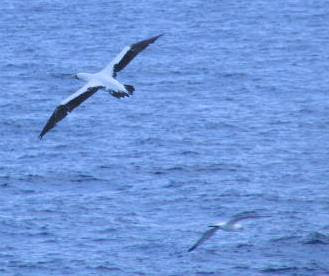
Seagulls

Seagulls are not really my favourite. I think my dislike stems right from my cadetship, when I would spotlessly clean or paint the deck & a seagull would come swooping down from the heavens, crap on the deck & nonchalantly fly away to another part of
the deck to repeat its handiwork.

As I progressed along the ranks, I grew slowly possessive of the ships under me & the behaviour of the Seagulls was simply unacceptable. In most parts of the world, these chaps are excellent fliers & often glide in place for up to fifteen minutes
without moving a wing. Actually that would be neat in itself, but what happens is that they keep pace with the moving ship & maintain their position without flapping a wing. As the ships bows break through the waves, they glide around the bow, waiting
for the fishes to break through the frothing sea before they would dive & in my fervent imagination, be run over by my bows to be gruesomely killed in the churning propeller.

But that was not to be. A few seconds later the seagulls would come bobbing up the water, often with fish in their beaks & then go back to floating above my foxel & ejecting the same fish from their hind parts.

I met these seagulls in the caribbeans & these guys I like. They are really horrible at gliding in place & keep swooping in their sleek bodies all over the place. And they don't crap much.


Thursday, September 13, 2007

USS Yorktown

Yesterday we had seen the Bridge at Savannah. Let us go back to the Charleston Bay Bridge. In the picture you have one of the pillars of the Bridge & in the back ground is the Aircraft Carrier USS Yorktown. The Yorktown is a uncommissioned warship &
serves as a museum these days. I had gone on a similar Warship Museum at Texas city & they maintain the whole thing very well. That one had even got an Aircraft Simulator type of movie in it featuring an actual mission in the Persian Gulf.

For some reason, the Radar antennae of the warship was turning. Pretty weird considering that she could hardly have moved an inch in a long time.


Wednesday, September 12, 2007

Portland Senetor at Savannah

Pictured above is the Portland Senetor in the Savannah River & in the background is the Bridge over the Savannah River named the "Eugene Talmade Memorial Bridge". I'm not sure anyone calles it that though.

And the second picture shows us going underneath it at midnight. I had taken it on longer exposure so the thing has come out a little blurred.

The savannah is a gently meandering river that snakes its way between the borders of two of the Western states of the US & the activity along it is surprisingly heavy. Most of the shipping traffic like Jettys & the terminals are built along the
southern shore and because of this they stretch right along the river till more then fifty miles inland, So you actually have substantial traffic moving in the river even though there might not be much to see out there.

I remember that I had gone ashore in Savannah as a third mate & for the first time in my life discovered a place called an "Army-navy sulprus store". The amount of cool stuff out there had lit up my eyes.


Monday, September 10, 2007

Flag Etiquette

The Carribians : 13 16 N, 069 56 W, Spd 13 Kts

Let's go back to the container ship Tokyo Express that we had seen a couple of posts back. Seen in the picture above are the flags on the main mast above the Wheelhouse / Bridge. On the extreme right we can see the Smoke stack or the funnel of the ship
painted Orange & then the three windows of the Bridge. On most ships, the flags have to be hoisted by going above the Bridge, to a deck called the Monkey Island. But on Tokyo express the flag halyards seem to be tied to the Bridge deck on the area
outside the enclosed bridge. This area is called the "Bridge Wings".

International Flag Etiquette is very clear on the method of hoisting flags on the merchant ships. The last time we saw Tokyo express, I had shown you the Jack staff where the Flag of registry (Germany in this case) was hoisted. It is on the main mast
that the rest of the flags are hoisted.

The flag on the Extreme Starboard of the main mast is always the country of visit. As the snap was taken in Savannah, we have the star spangled banner fluttering in a northerly breeze. Some countries like Saudi Arabia want their flag hoisted on the
forward mast.

The flag after the Visiting countries flag is generally the house flag. A house flag is the flag of the owner. In this case they have put the house flag as the third from the stbd. It is the Orange & blue flag. It's a common error that the flag
hoisting seamen do, but not serious enough as the visiting country officials are not bothered.

Back in the old days, when communication between ships was limited, each alphabet was assigned a flag & each alphabet was given a meaning. The full list of the Signals can be obtained in the International code of Signals that is an standard
publication.

The second flag is one such flag & is the "H" or "Hotel" flag & is meant to represent "I have pilot on board." It is very unlikely that a vessel tied up at berth would actually have a pilot on board, but due to the short port stays with the container
ships, the flags are often kept up.

The Last Red colored flag is the "B" or the "Bravo" flag & is meant to represent "I am loading or discharging dangerous cargo". In all likelihood, every port of discharge would have a couple of containers of dangerous cargoes. So this must be another
flag that the seaman must have standard instructions to put up.


Mona Passage

Mona Passage : 17 54N , 068 06W , Spd 13.0 Kts ,Co -200(T)

For anyone desirous of entering the Caribans, there two main passages to go through. The Windward passage, & the Mona Passage. The Windward passage is between Cuba & Haiti, whereas the Mona passage lies between the Dominican Republic & Puerto Rico.

The passage is called Mona because of the Mona Island that guards it. Today was a bright & beautiful day & the visibility was great. If you look at the chart of the Mona Island, you can see that its a circular Island with about a miles radius. Its
great to look at from Google earth & you must try it out sometime.

The pictures along with the chart are of the Isla Monita, a small rock jutting out of the ocean a few miles northwest of the Island (also there on the chart) & the full Mona Island as seen from a distance of about 5 miles.

An interesting thing about British Admilarity (BA) Charts is that the UKHO has decided a few years back to start using the local names of the places in their chart. So, if you dig up an older version of the BA chart, you'll find that "Mona Island" has
made way for the present "Isla De Mona". The scribbling made by the pen on the chart is the permanent corrections that have come over the years & are entered in pen. But the workmanship leaves a lot to be desired, to say the least. On the South west
corner is the correction "Turtles - see note". This note refers to the turtles that visit the Island, and basically asks people such as myself to not disturb them. A great place to dive I'm sure.

The third picture is that of the southwest tip of the Island. I'm not sure if you can make out the chart at the low resolution, but the picture shows you the Punta Arenas cliff & beach. Its in such Islands & beaches that Pirates such as Blackbeard left
their stash of gold. Maybe one of the voyages when the laycan is still off, I might anchor in the bay & get down with a spade!


Sunday, September 09, 2007

Tugs of the Savannah

Approaches to Mona Passage: 19 07 N, 068 05W , Spd : 13.4 Kts, Co - 172 T

There is a large lobby of ship enthusiasts that are ardent admirers of the Tug. The tugs are the work horses of the marine industry and are typically small vessels with a strong engine, built more for the power then for the speed. In fact a normal
cruising speed of a tug rarely crosses 10 kts.

Pictured above are a couple of tugs that passed by in the Savannah river. The Edward Moran is a typical tug used for ship handling & it is really beautiful. The tug is a classic and is built along the lines of the tugs made in the late 70's & eighties.
I won't be surprised if that really was the age of the old lady as some of these vessels can last a long time in the rivers fresh water.

The second tug, ugly by most descriptions, including some of my own, is the tug "Savannah" The reason that its front is cut off into a blunt end is because its really meant to carry barges. The US applies cabotage law along its coast. Under this law,
only US vessels can carry oil & cargo along its coast. What this law has resulted in is that bigger ships like ours brings oil from Abroad & discharges the cargo in a couple of ports of US. Then this cargo is transferred to smaller barges (Though
barges bigger than the Asian Standards) and then pushed along the coast by barges such as the Savannah. These type of tugs are designed to fit in behind the barges & the once they are tied snugly, push the barge.

If an older tug like the Edward Moran had to shift a barge, then she would have to tow it around, which is a much harder proposition, require greater skill & dedication. So now we have these deformed punk tugs running all over the US coast.

Well maybe they won't look so bad once tugs like the Edward Moran aren't around to remind us.


Saturday, September 08, 2007

Tokyo Express in Savannah

Posted north East of Bahamas : 22 32 N, 070 51W, Spd 13.1, Co 131.8

All mariners think of ships as women. Probably because we don't see many of the real ones. But notwithstanding any and all allegations of sexisms, you have to agree that you can tell a lot about a ship from the way her stern looks.

Pictured above is the Container Ship Tokyo Express discharging Cargo at Savannah.

The information garnered from the picture of the Stern is as follows:

Name : Tokyo Express
Port of Registry : Hamburg
IMO Number : 9193290
Call Sign : DGTX

Points of note:

The picture also shows some neat points of interest to those who think that those points of interest are neat. Firstly, the lifeboat used on the ship is that of the free fall lifeboat. The advantage of these lifeboats is that the owner is required to
install only one of these on the ship. Conventional lifeboat fittings require each side of the vessel to have lifeboats for the total life saving capacity of the ship. The problem with this kind of a lifeboat is that the crew required to go down the
life boat free falls into the water from a height of about 20 meters. Contrary to popular belief, the modern day mariners are not very adventerous.

If you note the call sign of the vessel is marked on top of the lifeboat. Also one intresting thing is that the aft stations (from where the ropes atre passed) is under a deck and is enclosed. It all looks funny to tanker men like myself.

The Second picture shows a dockworker removing the container lashings so that they might be discharged. He is currently opening the cross bars that are still present on his right & their function is self evident. What can't be seen are the twist locks
that are underneath the containers & lock by twisting at the four corners of the containers. Heavy things they are and it used to be a pain to us as cadets to collect them all in the hatch & bring them up at the end of the discharge.

Finally I'm not sure how good the picture is, but on the railing port of the lifeboat is the Jack Staff which has the Port of Registry flag (Germany in this case) & on the stbd is the small mast having the stern lights which are the navigational lights
fitted on the aft facing direction so that ships can be seen from a far enough distance.

Now if only we could pass a legislation to fit these on women...


Friday, September 07, 2007

Free!

Posted North of Bahamas : 27 51 N, 077 35W


It always surprises me how far you can see out at sea. After the months of being at home, when you finally do step out on the bridge of your ship, the horizon is so far far away that you wonder if you ever will catch it.

It is good to be out at sea & especially good to be out of the US. I think I had told you about the IALA buoyage system & how the US has an opposit system in place. Well I always feel that you are going the right way if you keep green on the Starboard.
This seems more then symbolic when you have to keep the green buoys on your Stbd as you leave American port.


Wednesday, September 05, 2007

Charleston Bay Bridge

I have been sailing on the larger ships for so long that I had almost forgotten how much fun it was to pass under the bridges. Charleston was a dreary place. It was cloudy & rained pretty much throughout the stay there. For some reason, there was no
city in evidence. Most US cities that I have seen are characterized by these clutter of high rises that the Americans inevitably call downtown (I have no idea where that would be in an Indian city) & then spread all around it would be the industrial
area, the warehouses & then the suburbs. If Charleston has a downtown with high rises, they were not visible from the river. But it does have a stunning bridge going for it. The Charleston bay bridge has a charted clearance of 186 feet and we with an
air draft of 132 feet would have comfortably passed under it. But like getting out of a chopper, you always feel like ducking every time you pass under one of these.


Tuesday, September 04, 2007

US Coast guard 211 at Charleston

Posted at sea : 30 35 N, 082 19W

When alongside the berth at Charleston, this Coastguard vessel passed by. Like the Naval ships, coastguard ships don't carry the names painted on their sides. This one seems to be a supply of support craft of some sort. Charlston is a small port but
there is a substantial presence of the coastguard. This presence is also manifested because there are fewer naval vessels here. I had got to speaking to a chap from the USCG & he was telling me that a pert of the movie "The Guardian" a movie based on
the rescue squad of the USCG, is based on the camp at Norfolk hardly a couple of hours drive from here. I think I'll have to watch that movie again.

That capable fellow told me that there was a bigger presence of the USCG at Norfolk, but the staggering mass of the Naval contingent there meant that no one really noticed the USCG. Or as he put it, " They don't notice us - till things start going
wrong!"

This is also a great snap to see the container handling cranes in the background. These cranes are stowed in the picked up condition when not in use & are lowered once the container ships come to the berth.


Sunday, September 02, 2007

Helicopters

posted at sea : 31 49 N, 069 56W

I have been seeing a lot of Helicopters over the last few days. Smaller ports like Charlston & Wilmington didn't have many of these, but Baltimore & Chesapeake had plenty of them. The ones near Chesapeake & Norfolk were mostly military ones but
Baltimore had all types of choppers from News, medevac to Police Choppers. The Chopper refueling jetty was near our Terminal so we would see choppers coming every twenty minutes or so to Land, take fuel & then be on their merry ways.


Saturday, September 01, 2007

Chesapeake Bay Departure

GPS : 32 39N , 079 39W

To come out of the Baltimore port, you have to go through a pilotage for about 14 hours & then pass out of the Norfolk & Chesapeake Bay area. As we were coming out of the departure channel, we met another Aircraft carrier on the way in. The Chesapeake
Bay & the Norfolk Naval base are featured a lot in the Tom Clancy Novels & my Brother is very fond of them. I wondered if he was around here, he would have had great fun thinking about the area where Jack Ryan had fun with the Red October.

Sadly the Aircraft Carrier didn't have a single plane above deck & had only one Helicopter that was going all over the place. I suppose if you are the Captain of an aircraft carrier, you can post a lookout pretty much where you want!